
More Details
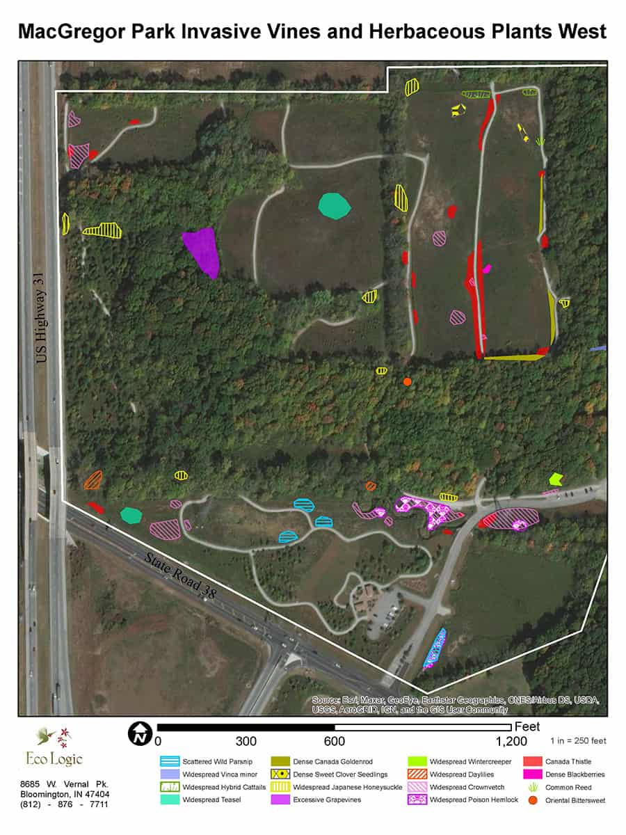
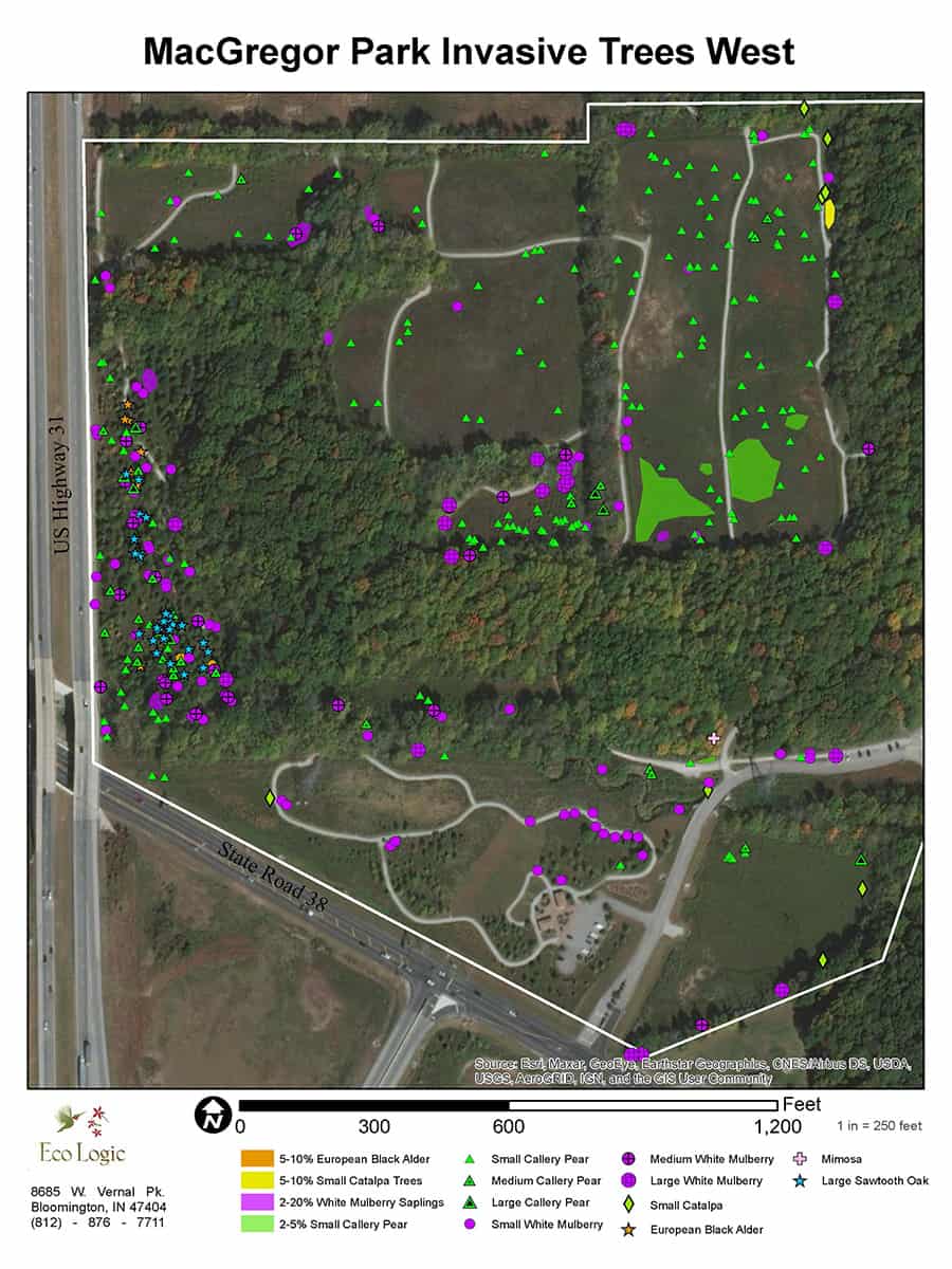
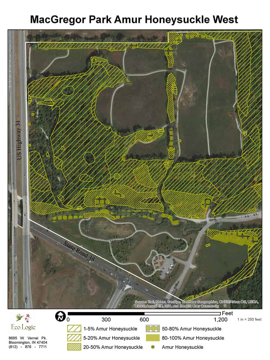
Eco Logic was contracted to map the invasive plants populations in this large park in a rapidly developing area of northern Hamilton County. Most of the land in the park is 2nd growth woodland that is 50-100 years old. Some larger and older trees occur in the ravines. Several former agricultural fields and a powerline right-of-way have been planted to prairies. Recent reforestation efforts have also occurred in the small openings in the park. The boundaries of these communities were mapped and each community was assigned a rating based on their ecological integrity.
Mapping was performed by taking GPS points and recording the species and densities of invasive plants at each point. The points were displayed on a Geographic Information System map and polygons were drawn around similar densities for each species. A table of the species that were found was made that indicated their threat level and recommended prioritization. A list of recommended stewardship priorities was also included.