
More Details
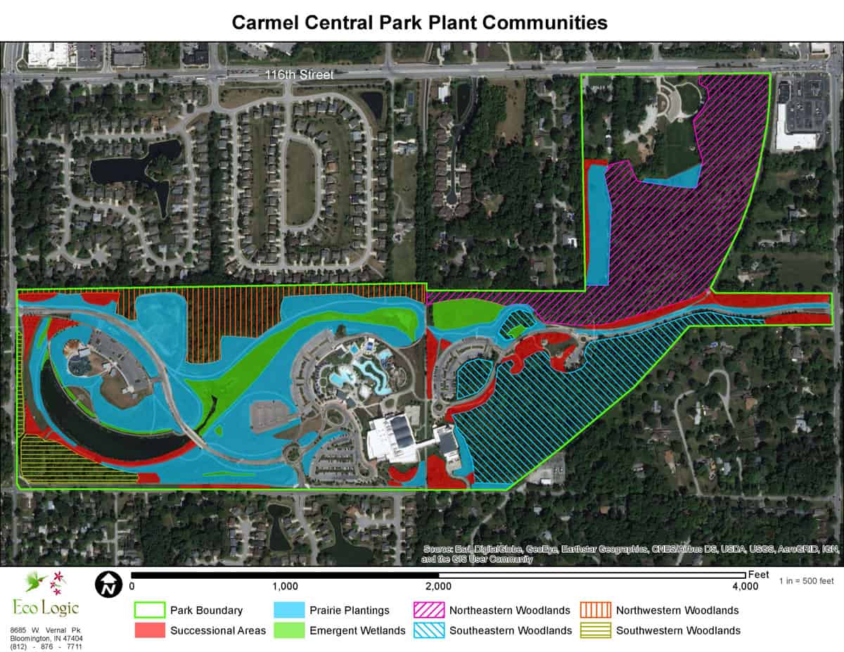
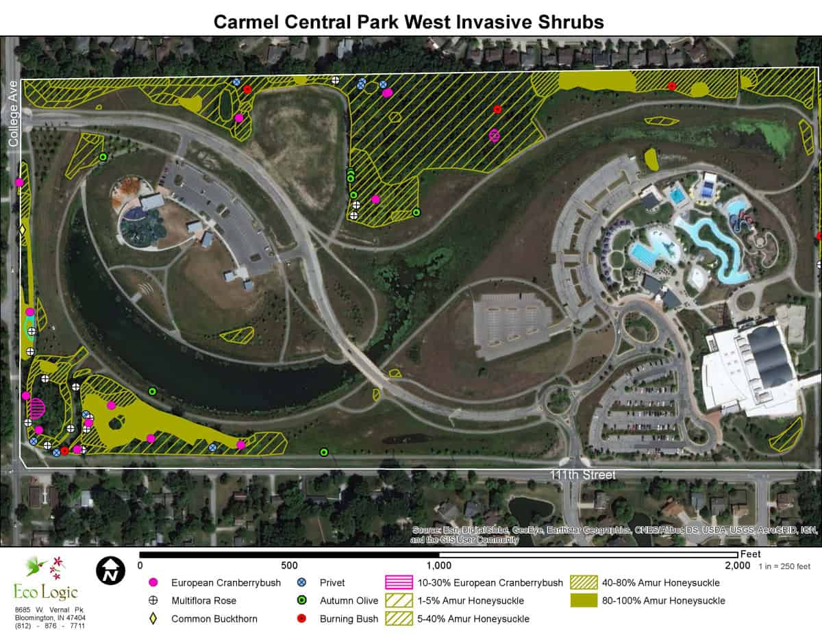
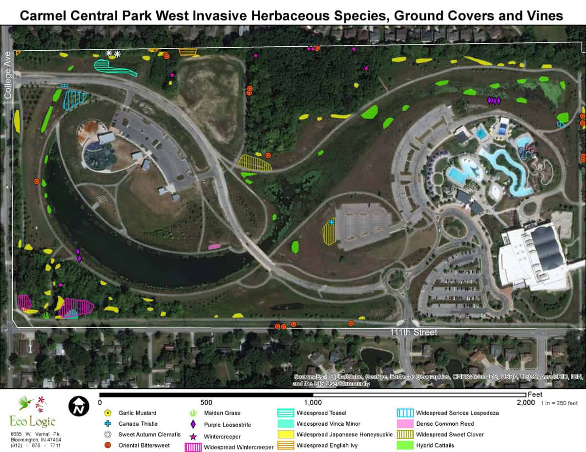
This large park in Carmel Indiana contains prairie plantings, wetlands, ponds, young woodlands, and mature remnant woodlands. Situated in the dense urban area, it is prone to a large variety of invasive species escaping from ornamental planting in the surrounding neighborhoods. Eco Logic was contracted by the park district to map the invasive species and densities over the entire park to provide the background information to develop a plan to prioritize removal. Eco Logic Senior Ecologist Kevin Tungesvick spent two days walking transects through the park recording GPS points of the invasive species and their densities.
This information was then utilized to map points for invasive species that existed in low densities and polygons of the densities of species that were more widespread. The GIS maps produced from this process may be utilized with apps on mobile devices to locate and treat the invasive species. Included with the report were descriptions of the plant communities and their characteristic species. The report also included descriptions of each of the 31 invasive species and their relative level of threat and prioritization of removal. GIS shapefiles of the points and polygons were provided to the client.